


Whistler Pumps & The Alps Dump
The Arctic corridor opens on Europe next week as it potentially sees back-to-back systems starting Sunday night.

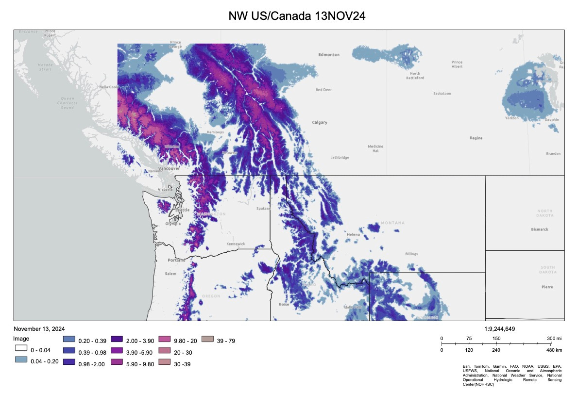
SW Canada & parts of the Pacific Northwest, above 1600m have revelled in solid early season snowfalls (as per the outlook HERE).
NOAA’s Snow Water Equivilent plots suggest the high alpine areas have accumulated anywhere from 40-80cm of new snow since Monday.
As the clearing trend accompanies the dropping freeze level on Friday, all eyes turn to the next system due Saturday and into Sunday, where resorts could accumulate another 20-35cm.
Keep reading with a 7-day free trial
Subscribe to The Snowstack to keep reading this post and get 7 days of free access to the full post archives.