


Weekly Update: Western Canada & Japan Are on a Roll
While Europe bathes in bluebird for much of this week, Western Canada & Japan stand in the way of some fruitful winter flow.

WESTERN CANADA/USA
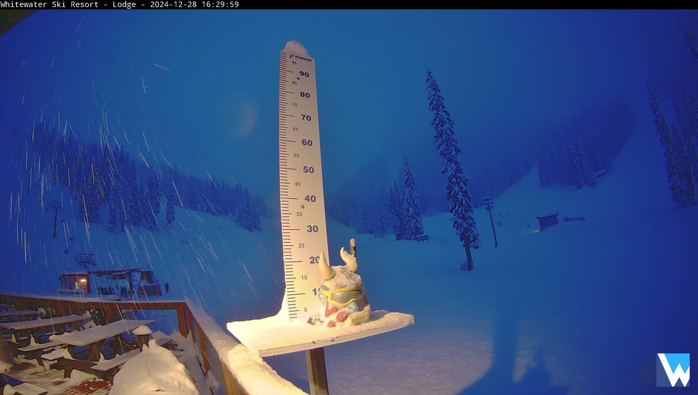
Approaching a 2-metre base throughout much of Western Canada & The Pac NW, resorts are humming at near-mid-season averages, top-to-bottom this week. It’s been a fortnight of back-to-back systems as the last of the onslaught hits the Pac NW tonight before a new cycle of systems arrives Tuesday night, Wednesday morning.
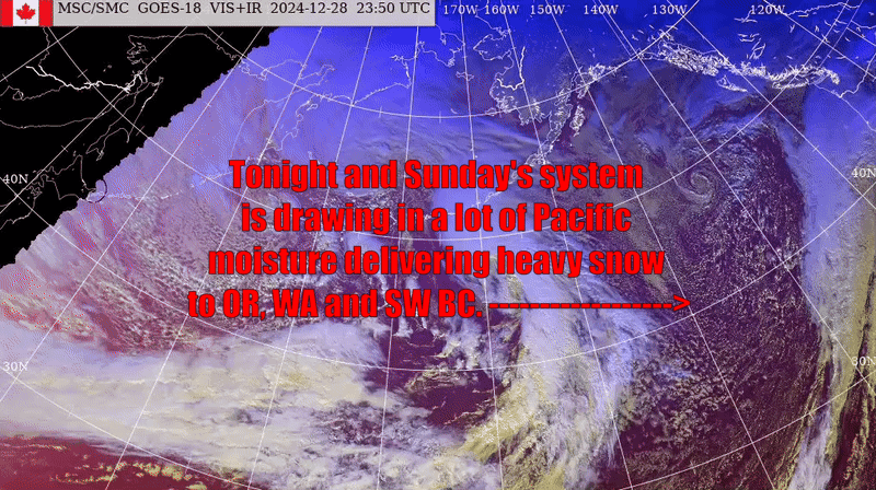
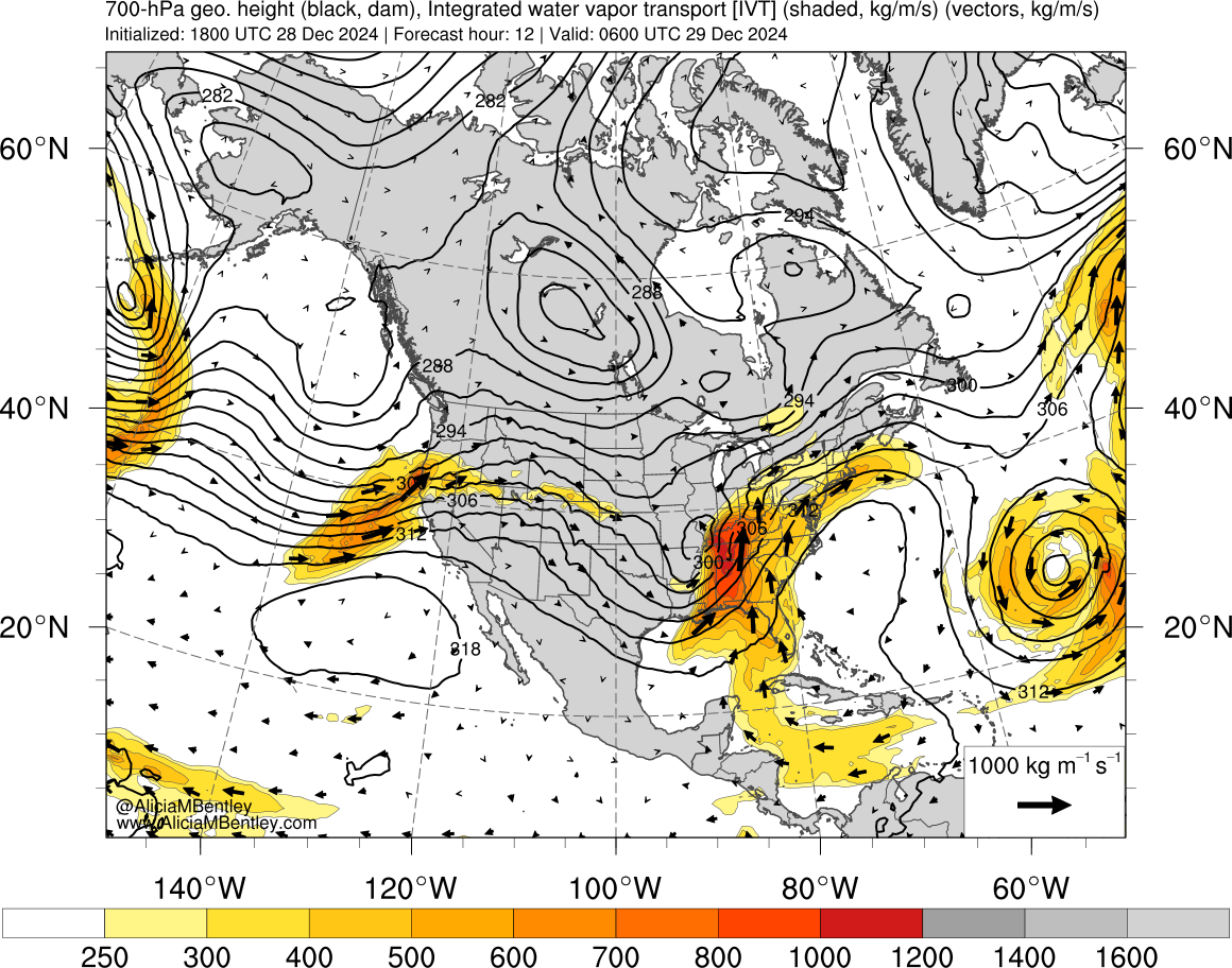
The system arriving tonight is an interesting one as it is drawing in an abundance of moisture. Put simply, it’s your ‘mild’ variety Atmospheric River event, with Oregon and Washington alpine areas in the firing line, set to accumulate 8-12” (20-30cm) by early Monday morning, local time.
There are some indications of 15-20 inches (40-50cm) in high-alpine areas.

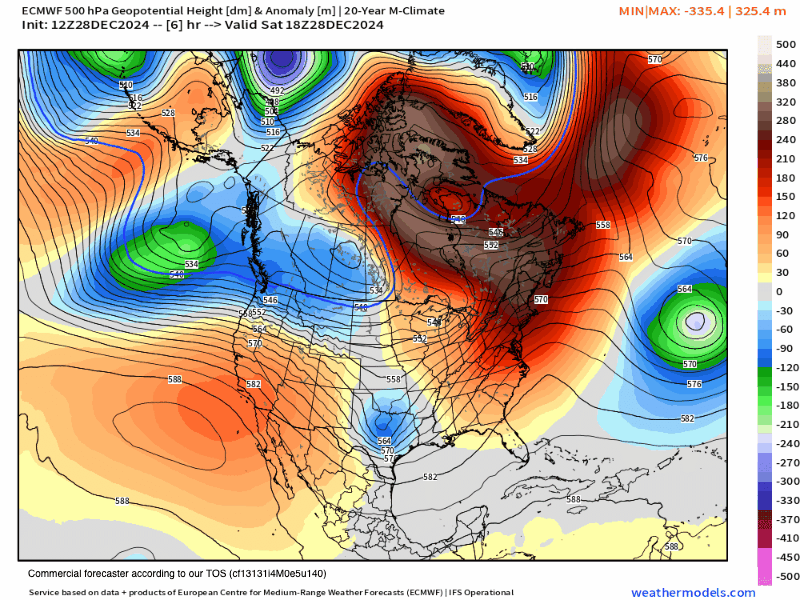
The brief clearing trend will be shortlived as the persistent (albeit light) onshore flow offers light-to-moderate precip throughout Monday/Tuesday as the attention shifts to the interior US/Rockies.
Central Rockies are expected to receive 10-15 inches (25-40cm) by Monday morning locally, with a. subsequent system pushing through on Wednesday evening.
Keep reading with a 7-day free trial
Subscribe to The Snowstack to keep reading this post and get 7 days of free access to the full post archives.