The Full Frontal Arrival
Today's frontal feature has arrived and currently verifying throughout populous areas of NSW.
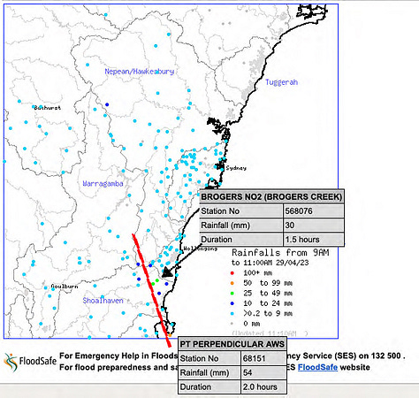
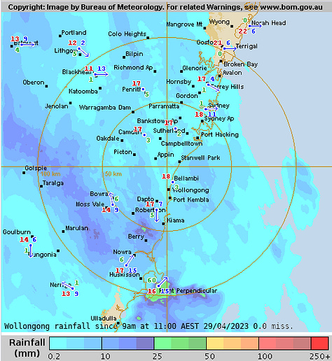
As mentioned yesterday via my Substack Notes, global models have been alluding to a defined axis of instability forming today from Point Perpendicular, NSW through Warragamba, to the Blue Mountains region.
Here comes the verification.
As of 11am, Point Perpendicular has acuumulated 54mm in just 2 hours and Brogers Creek sitting on 30mm in 1.5 hours.
Below are are the 11:00 hrs 29APR observations (click for enlarged images).


This axis also acts as the demarcation between warm surface temps (New England tablelands, Mid-North and North coasts) and the cooler post-frontal airmass, throughout the interior.
11:00hrs temps of 12-17°C through SW NSW.
Keep reading with a 7-day free trial
Subscribe to The Snowstack to keep reading this post and get 7 days of free access to the full post archives.


