


Long Range: There's a Red Herring in the Tasman
A Tasman Low is projected to have major influence along Australia’s East Coast next week—but be careful what you bank on.


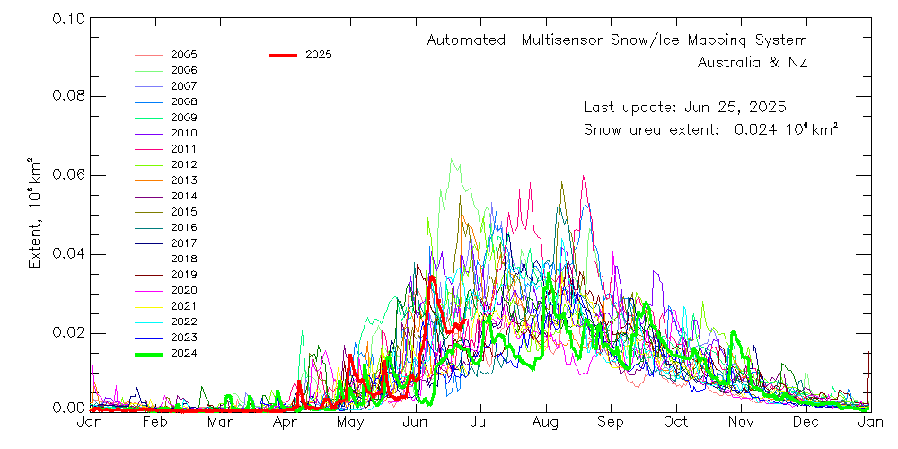
One of the best starts to the Australian Ski Season has been reached as we enter our fourth week of the snow season. Resorts accumulated 35-50cm in the upper reaches of the resorts this week.
Mountain Safety Collective is now reporting ‘Moderate Avalanche Danger‘ in today’s Alpine report, with wind slab danger to be considered in route planning in the high alpine.
The Outlook
There’s a growing murmur about a possible Tasman Low brewing over the next week—one that might just spin up enough moisture and cold air to deliver snow from the east. Current model guidance shows decent consensus on a low deepening off the NSW coast by Tuesday, but the real wildcard lies in what it does next: will it tuck in behind the Alps or peel away harmlessly into the Tasman?
Tasman Lows are notoriously slippery systems to forecast. Born off the subtropical east coast, they need a rare alignment of ingredients—track, timing, and temperature—to make good on their snowy promise. This one’s no exception.
Near-Term Outlook
Things kick off with a fairly benign cold pool drifting up the east coast—a quiet wanderer, nudged along by a blocking high parked over South Australia. This high holds firm for the next few days, guiding the cold pool northward and setting it up for a complex outlook.
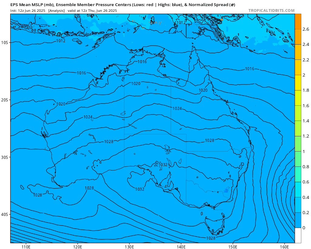
From Tuesday, we can expect to see the low impacting and deepening off the North-Coast of NSW.
Keep reading with a 7-day free trial
Subscribe to The Snowstack to keep reading this post and get 7 days of free access to the full post archives.