


July Entering Stage Left
A strong polar system poised for the second week of July looks set to mop up the mess left behind by the Tasman Low glancing the east coast in the coming days.

If we can look past the next week, July is shaping up to pack a punch.
But First This Week….
There’s snow in this Tasman Low, bearing down on the east coast over the next 48 hours, but there’s also warm, moist air pushing in from the east (and northeast) — so expect rain too.
Remember That Red Herring….
NSW resort areas can expect around 5 cm of new (heavy, wet) snow down to 1700 m over the next 48 hours, while elevations above 2000 m could see up to 20 cm by Wednesday night. Snow levels fluctuate with heavy preciptation bands, tomorrow.
Expect 25–40 mm of rainfall across the alpine region.
So, where were we? July… Ah yes!
Next Week
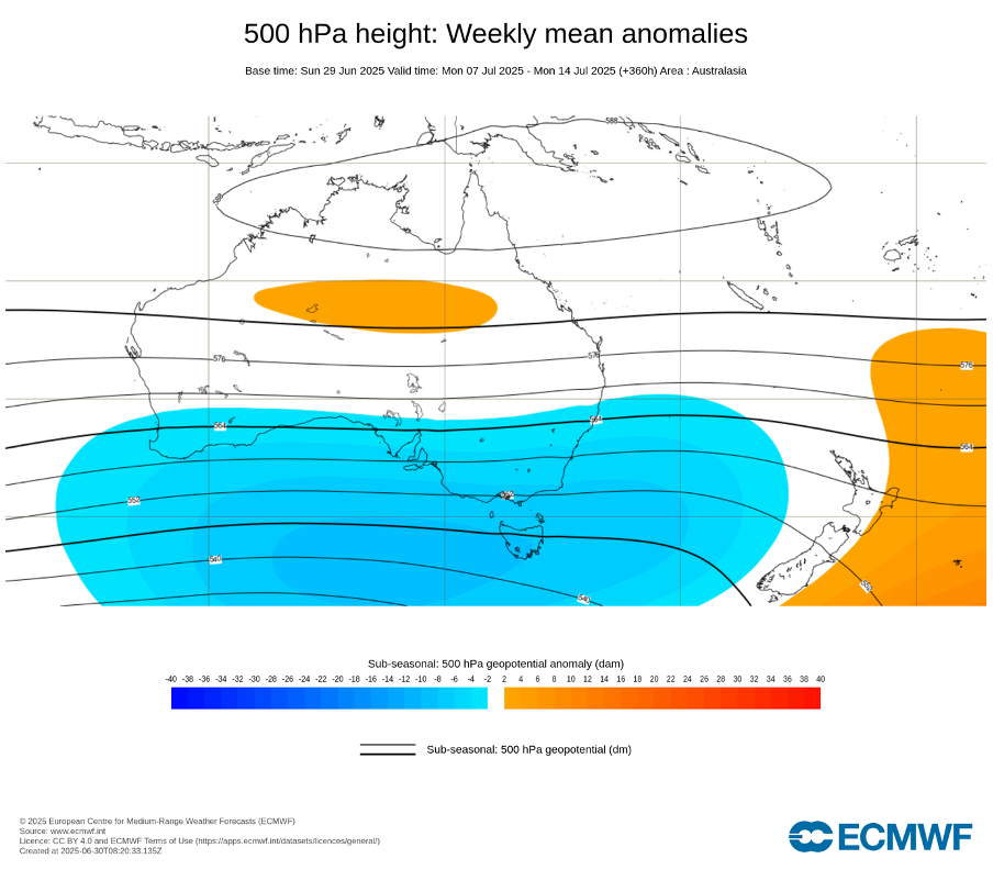
Long-range models are not only in agreement—they're doubling down.
It’s rare to see such a defined signal 10–14 days out (noting this has been confidently on the models since last week). While caution is always warranted at this range, the growing consensus suggests this system means business as we approach the heart of the Australian winter.
Keep reading with a 7-day free trial
Subscribe to The Snowstack to keep reading this post and get 7 days of free access to the full post archives.