

Hemispheric Flip: Vortex Weakening and a Shift in Snow Corridors
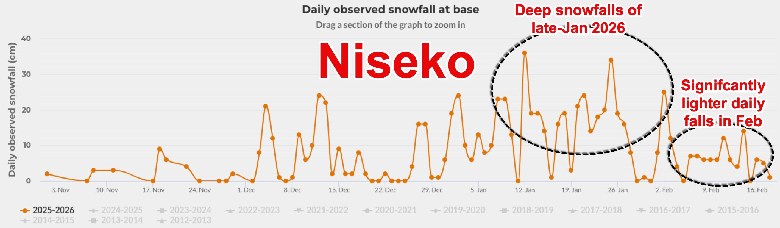
Mid-February’s pattern reversal verifies, with Europe and western North America surging under amplified flow while Japan steps back from its January extremes.

The pattern shift proposed back in early February has verified, and we’ve seen a flip in hemispheric conditions over the past week, where Western North-America, Europe have seen extraordinary snowfall and heightened avi-risk over the past week. Conversely, across Japan, we’ve seen an abrupt abatement in the extraordinary snowfall event in the second-half of January.
Stratospheric Polar Vortex Outlook Summary
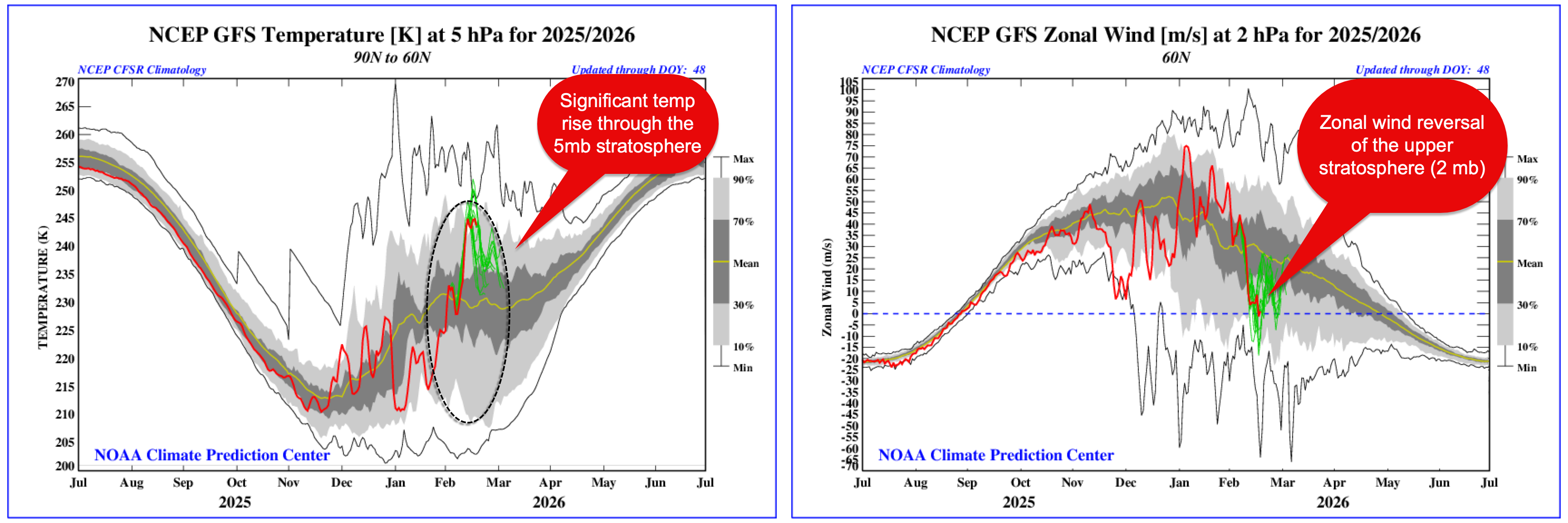
The stratospheric polar vortex is a broad ring of strong westerly winds that encircles the Arctic high above the surface, strongest through winter as the pole cools and darkness sets in. When consolidated, it locks the coldest air into the high latitudes and supports a more zonal, progressive mid-latitude pattern. When disrupted by wave activity propagating upward from the troposphere, the vortex can weaken, become displaced or even reverse, allowing cold air to spill further south.
In this case, the initial trigger was an extreme warming event in the upper troposphere observed in late January. That tropospheric amplification has propagated upward, with the upper stratosphere responding over the past fortnight. We are now seeing a marked temperature rise through the 5 hPa layer and a reversal of zonal winds near 2 hPa (figure below), clear evidence that the vortex has been significantly weakened aloft. The disturbance is most pronounced in the upper levels for now, but the structure beneath is beginning to respond.
Way does this matter? We’re seeing a the start of the continued pertubations that will have lasting impacts on the worthern winter in around 2-3 weeks time.
