

Broadscale Shake-Up: The Winter Pattern Is In Flux
An imminent tropical breakout is underway, delivering Australia’s best chance at a late-season winter surge. How long could it last?

Confidence is mounting around the long-range signal tracking towards southern Australia next week. The long-wave feature has all but locked in for the south-west of the continent, peaking around 6-8th August. You’re probably thinking, well… That’s nowhere near the Aus Alps. And you’re not wrong, but this is where the models diverge - AI models strengthen the wave as it transits eastward while the European model fades it back into the Southern Ocean. How many times have we seen that happen already this season?
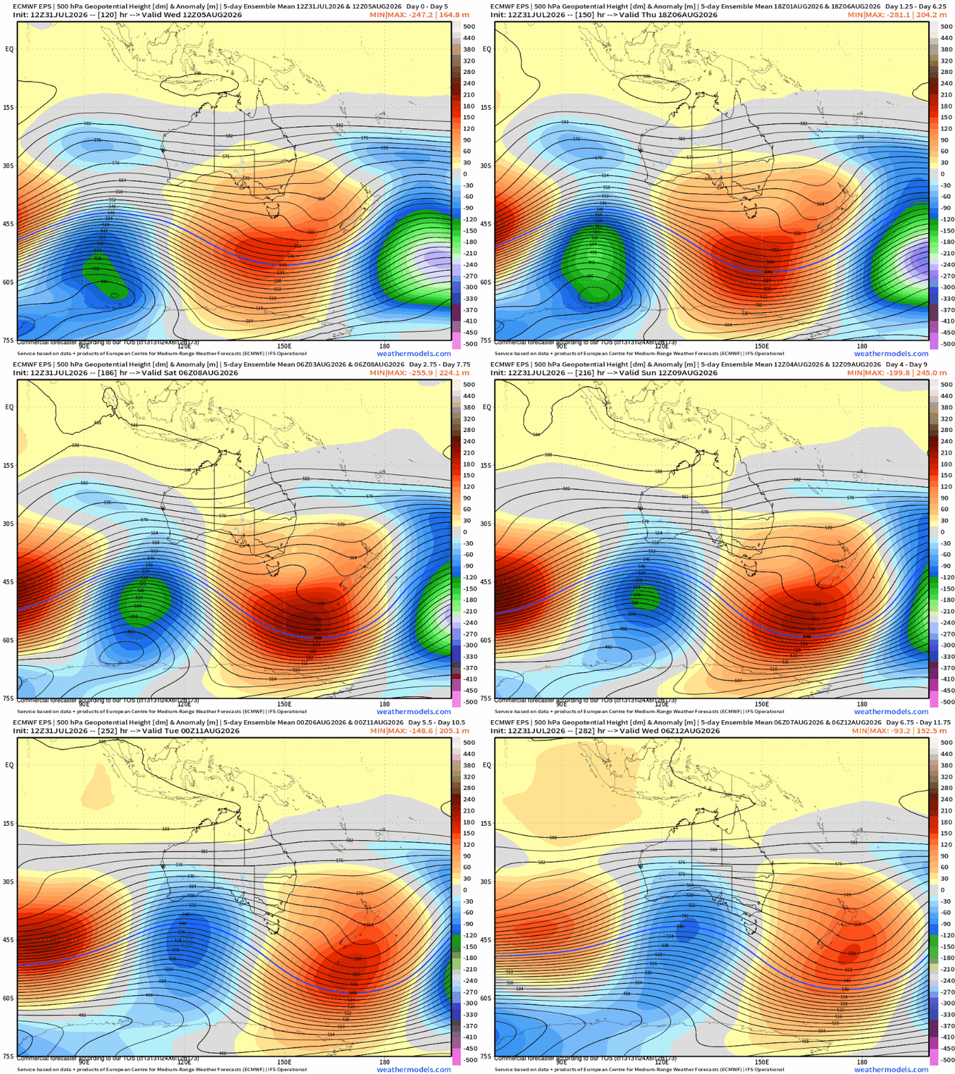
The consensus amongst the models at this point is that a strong node of polar air will push through south-western Australia at the end of next week. It’s a formidable node and one that bears the hallmark of being driven by the imminent tropical activity across the Pacific.
Keep reading with a 7-day free trial
Subscribe to The Snowstack to keep reading this post and get 7 days of free access to the full post archives.