


Another Early Peaker
A polar low peaks in the Bight before diving south this week, offering the Australian alpine only shades of a classic mid-winter dump this week.

Outlook Summary
A polar node peaks in the Bight on Monday
Delivering northerly flow over the alpine on Tuesday
Frontal pattern slides south-eastward on Wednesday
5-15 cm Monday night to Wednesday for ski areas
Western alpine areas (Mount Buller et al.) to pick up the upper range of snowfall totals
Large warmer feed out of the north-west on Saturday
Snowfall in the rear of Saturday’s system
As we turn the corner through winter solstice we see parts of our polar regions in perpetual darkness and the polar airmass broadening to reach seasonal peaks.
Near Range Outlook - An Unchanged Outcome
This week, guided by the positive SAM climate driver we see continental ridging tussle & win over the polar incursions in the midlatitudes of our region. The low is progged to peak in the Australian Bight tomorrow/Tuesday which will then be forced south-eastward through southern Tasmania on Wednesday-Thursday.
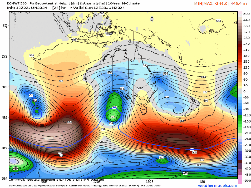
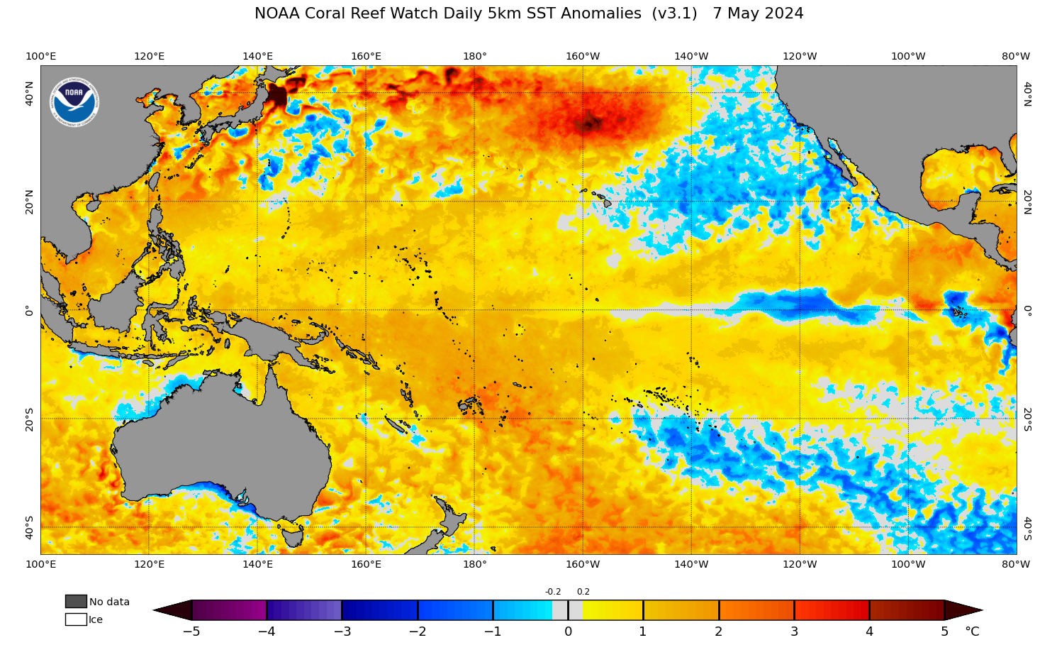
As the low deepens south of Adelaide to ~980hPa over the next 42 hours the low will be kept south (>42°S) meaning the bulk of the instability will be kept out to sea. With its deepening, however, it’s expected to draw a lot of moisture out of the anomalously warm Southern Ocean and in part northwest WA. This brings us to a similar circumstance as last week where we saw a system with a lot of moisture and cold air but lacking instability. We can blame that ridging (positive SAM signal) for now.
As such, we’ll be looking at a northerly flow throughout the event and trough feature influence as the fronts quickly decay over the continent. Given the spacial span between alpine ski areas, Victorian resorts that sit further west can expect to take the lion’s share of snowfall totals.
Snow showers will kick off on Tuesday (Vic), increasing into the evening. The bulk of the influence of the system will come into effect Tuesday night and Wednesday when we see the trough features deliver the diminishing instability.
NSW Main range can expect between 5-15cm Tuesday to Wednesday, while Victorian resorts should expect between 10-15cm.
For most of this event, we should see snow down to 1100m for Vic, 1200m for NSW alpine areas.
Long Range Outlook
Keep reading with a 7-day free trial
Subscribe to The Snowstack to keep reading this post and get 7 days of free access to the full post archives.